The hinterland of the Roman fort of Myd(---)/Gheriat el-Garbia on the limes Tripolitanus
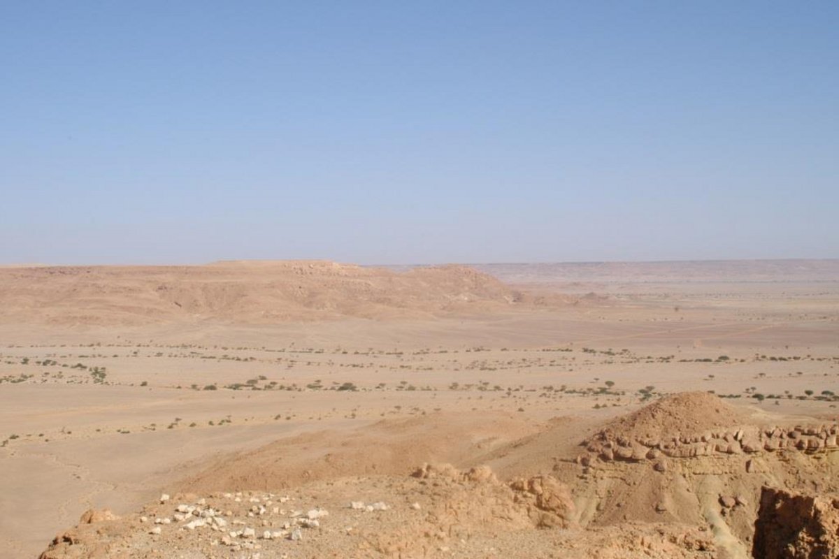 Pre-desert north of Gheriat el-Garbia
© LEIZA / F. Schimmer
Pre-desert north of Gheriat el-Garbia
© LEIZA / F. Schimmer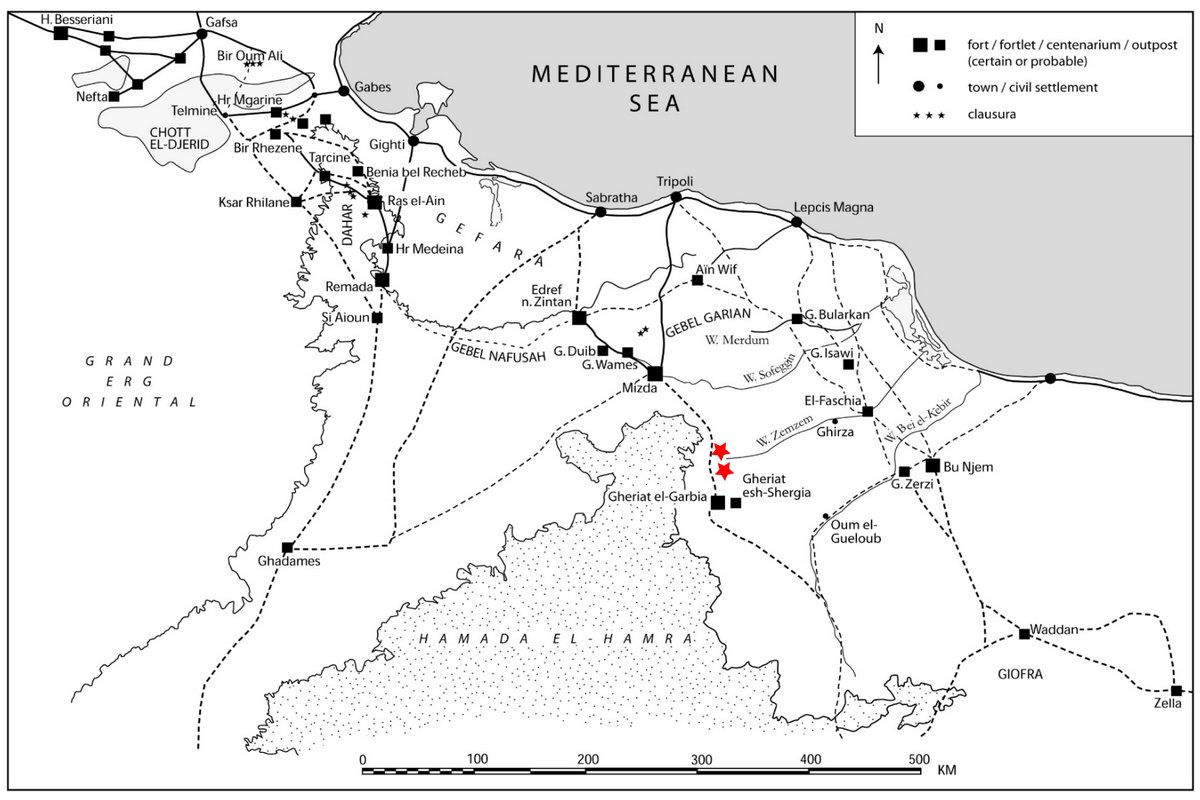 Roman military installations of the 2nd-4th century AD in Tripolitania (after M. Mackensen) with highlighted settlement sites in Wadi Taghiggia (above) and Wadi Wasiq (below)
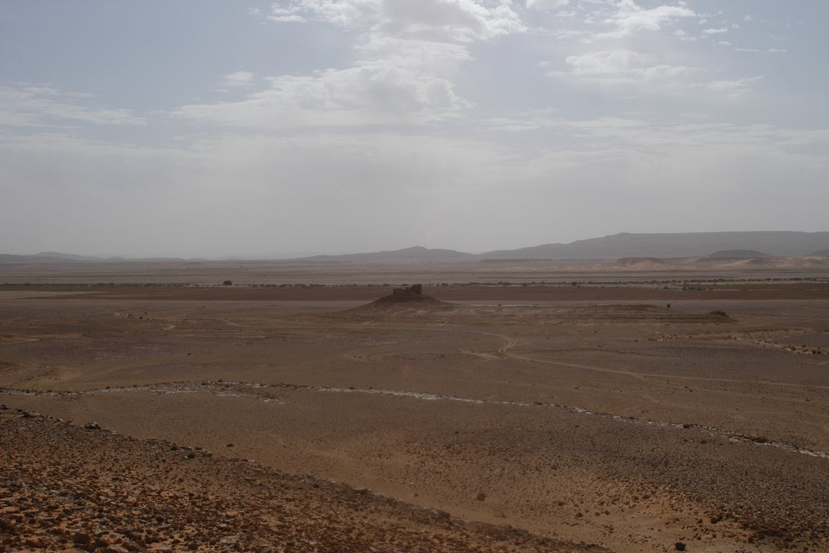 Wadi Wasiq from the north-west
© LEIZA / F. Schimmer
Wadi Wasiq from the north-west
© LEIZA / F. SchimmerThe region of Tripolitana (today’s southern Tunisia and north-western Libya) belonged to the province of Africa Proconsularis in the Roman imperial period and was established as an independent province in the early fourth century. Under emperor Septimius Severus (193–211 AD), the Tripolitanian pre-desert zone south of the fertile Gebel Mountains came under direct Roman control. For the military protection of this area, three so-called oasis forts were built at key strategic positions on the three most important north-south routes from the Mediterranean to the Sahara: Cidamus/Ghadames in the west, Myd(---)/Gheriat el-Garbia in the centre and Gholaia/Bu Njem in the east (Fig. 2). The largest of these fortifications, Myd(---)/Gheriat el-Garbia, was archaeologically investigated in 2009–2010 as part of the excellence project “Limes Tripolitanus” of the Ludwig-Maximilians-Universität Munich (LMU) under the direction of M. Mackensen.
The state of archaeological of research on the Tripolitanian pre-desert is relatively good, mainly thanks to the Unesco Libyan Valleys Archaeological Survey (ULVS) carried out by British archaeologists between 1979 and 1989 (Fig. 1). Little has been known, however, about the northern hinterland of Gheriat and the geographic ‘corridor’ along the traffic route from Gheriat el-Garbia to the military site of Mizda. This raises the following questions:
- What are the settlement and economic structures in this area?
- How was the Mizda-Gheriat route militarily secured?
- How did the interaction between the Roman military and the autochthonous, Libo-Punic or (partly) ‘Romanized’ population work within the particular natural conditions?
Research objective
The aim of the research project is to conduct archaeological research in the northern hinterland of Gheriat el-Garbia and the ‘corridor’ to the north as far as Midza with regard to the questions raised above. The focus is on material culture as well as specific building and settlement types.
Methodology
The starting point is two sites in the working area that have so far been largely ignored. These are a tower-like structure of unknown function, still preserved up to a height of 4 m, in the Wadi Wasiq, about 35 km north of Gheriat el-Garbia (Fig. 3), and a rural settlement site in the Wadi Taghiggia further north. In the vicinity of these sites, where no archaeological excavations had yet been carried out, significant ensembles of surface finds were collected in 2010, including fine and cooking wares as well as amphorae. The study of these finds will not only provide information on the dating of the sites in question and on trade relations, but also on the identity and way of life of the inhabitants. In parallel, the LEIZA and the LMU (M. Mackensen) are cooperating to investigate stratified find deposits and survey finds from the fort of Gheriat el-Garbia, which were recovered during the excavations in 2009 and 2010 and are to be compared with the find series from the hinterland as reference material.
In a further step, the geo-referenced recording and interpretation of the visible building and settlement structures in the working area is planned on the basis of aerial and satellite images.
- Copy link
- Print article
Contact
- Dr. Florian Schimmer
- +49 6131 8885-182
- Kontakt
- Prof. Dr. Michael Mackensen (Ludwig-Maximilians-Universität München)
- M. Mackensen, Das severische Vexillationskastell Myd(- - -)/Gheriat el-Garbia am limes Tripolitanus (Libyen), Bericht über die Kampagne 2009. Mitteilungen des Deutschen Archäologischen Instituts, Römische Abteilung 116, 2010, 363–458.
- M. Mackensen, Das severische Vexillationskastell Myd(- - -) und die spätantike Besiedlung in Gheriat el-Garbia (Libyen). Bericht über die Kampagne im Frühjahr 2010. Mitteilungen des Deutschen Archäologischen Instituts, Römische Abteilung 117, 2011, 247–375.
- F. Schimmer, New evidence for a Roman fort and vicus at Mizda (Tripolitania). Libyan Studies 43, 2012, 33–39.
- M. Mackensen, Survey and excavation of the German archaeological mission at the Roman fort of Myd(---)/Gheriat el-Garbia and its vicinity, 2009/2010. Libya Antiqua NS VI 2011/12 (2016) 83–102.
- M. Mackensen/F. Schimmer/S. Schmid/M. Weber, Keramik-Survey. In: M. Mackensen, Das severische Vexillationskastell Myd(---) / Gheriat el-Garbia am limes Tripolitanus (Libyen). I. Forschungsgeschichte, Vermessung, Prospektion und Funde 2009–2010. Münchner Münchner Beitr. Provinzialröm. Arch. 10 (Wiesbaden 2021) 155–214.