Tumulus and stone axes
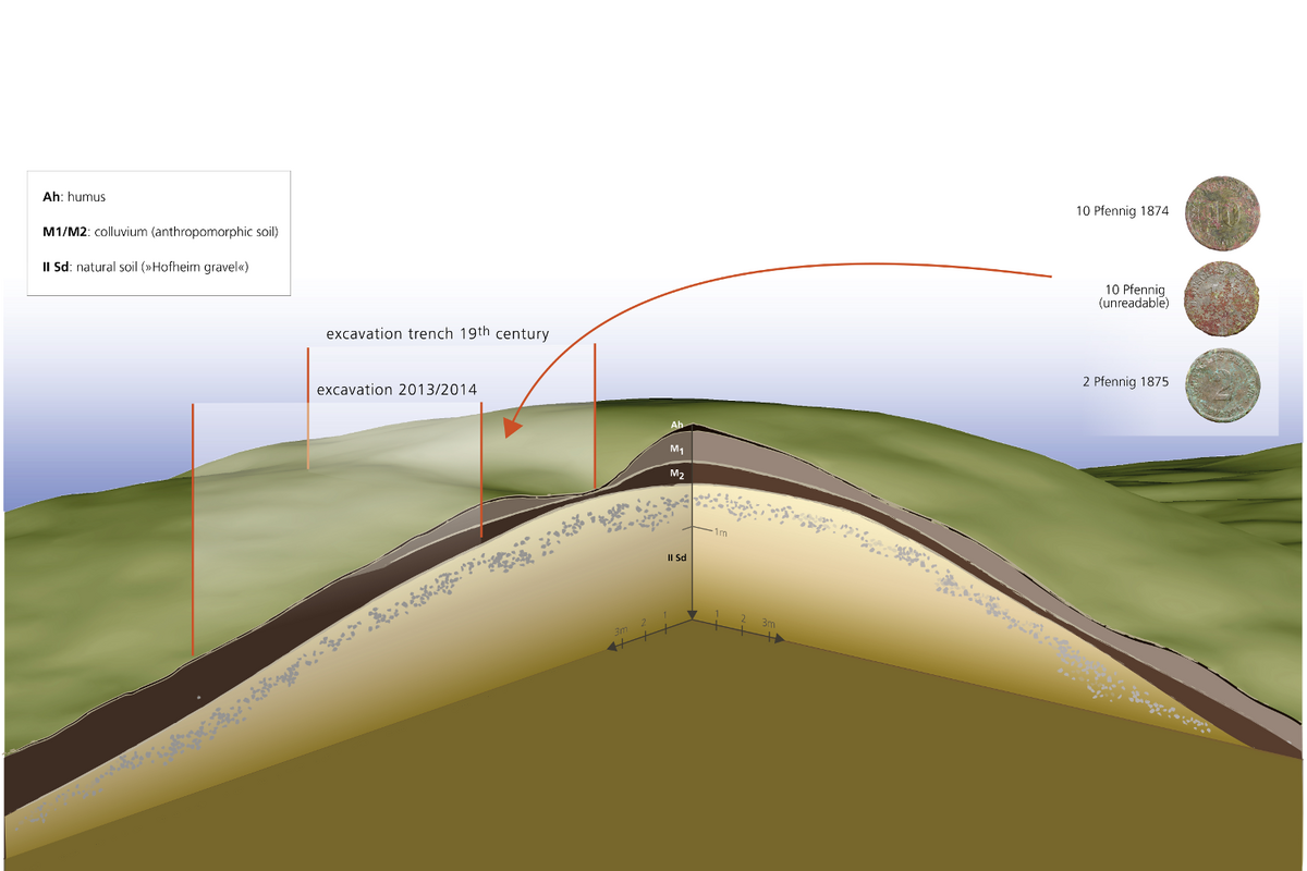 Three-dimensional depiction of the Kapellenberg tumulus with 19th century trench and coins found during a text trench from 2013. The 19th century trench might well mark the location of the original burial. On the side is the extension of another trench from 2013/2014
© LEIZA / M. Ober, S. Steidl
Three-dimensional depiction of the Kapellenberg tumulus with 19th century trench and coins found during a text trench from 2013. The 19th century trench might well mark the location of the original burial. On the side is the extension of another trench from 2013/2014
© LEIZA / M. Ober, S. Steidl Jade axe type Greenlaw/Altenstadt (1) and amphibolite axe Type Puy (2) from Kapellenberg, found around 1880. Stadtmuseum Hofheim am Taunus
© LEIZA / M. Ober
Jade axe type Greenlaw/Altenstadt (1) and amphibolite axe Type Puy (2) from Kapellenberg, found around 1880. Stadtmuseum Hofheim am Taunus
© LEIZA / M. OberThe stone axes
In 1893 both stone axes from Kapellenberg were published by August von Cohausen. They were supposedly discovered in a section of the outer rampart which can still be roughly located today. At that time Cohausen referred to a map he had published earlier. It needs to be stressed that he was not on site when the axes were found. In any case, the axes were found ten years before publication, during forestry work.
Therefore, taking all evidence together, it seems much more likely that the pieces came from a heavily eroded large tumulus, which had not been recognized at that time.
The axe blades were later examined in the course of the JADE project and the original attribution of the raw materials as jade and grauwacke was adopted. The jade axe is of the Greenlaw/Altenstadt type, the other of the Puy type.
In the case of the latter specimen, a renewed investigation at the former RGZM by Tatjana Gluhak showed that the raw material is very likely amphibolite. Today both pieces are on display in the Stadtmuseum Hofheim.
The tumulus
The burial mound remained unrecognized as such until Heinrich Thiemeyer identified it in the field and checked it against the digital terrain reconnaissance data (LiDAR) of the Hessian State Agency for Nature Conservation, Environment and Geology (HLNUG), which has been available since 2012. It is only clearly visible in the terrain from the west. Stratigraphic investigations show that its erosion was already completed during the beginning of internal settlement around 3750 BCE. The typology of axes suggests that it was erected around 4200/4100 BCE.
Large tumuli of this kind have not been documented in Central Europe for that period, but they do have counterparts in Brittany, especially in the tumulus of Tumiac.
The axes are probably the only remains of a burial in the centre of the tumulus. The skeleton itself was probably completely decomposed, when the remains of the grave were unintentionally destroyed during the construction of the forest path around 1880.
Notwithstanding these extremely unfortunate circumstances, the large tumulus remains the only monument of this size and date in Central Europe and underlines the connection of the Rhine-Main area to western Europe 6,000 years ago.
High-resolution 3D scans of the axes and interactive map
- Copy link
- Print article
Contact
- Prof. Dr. Detlef Gronenborn
- +49 6131 8885-129
- Kontakt