Determination of quantitative parameters of archaeological structures in high-resolution 3D data
Parameter determination from 3D LiDAR scanning and close-range scans with the help of self-developed methods as well as AI and machine learning algorithms
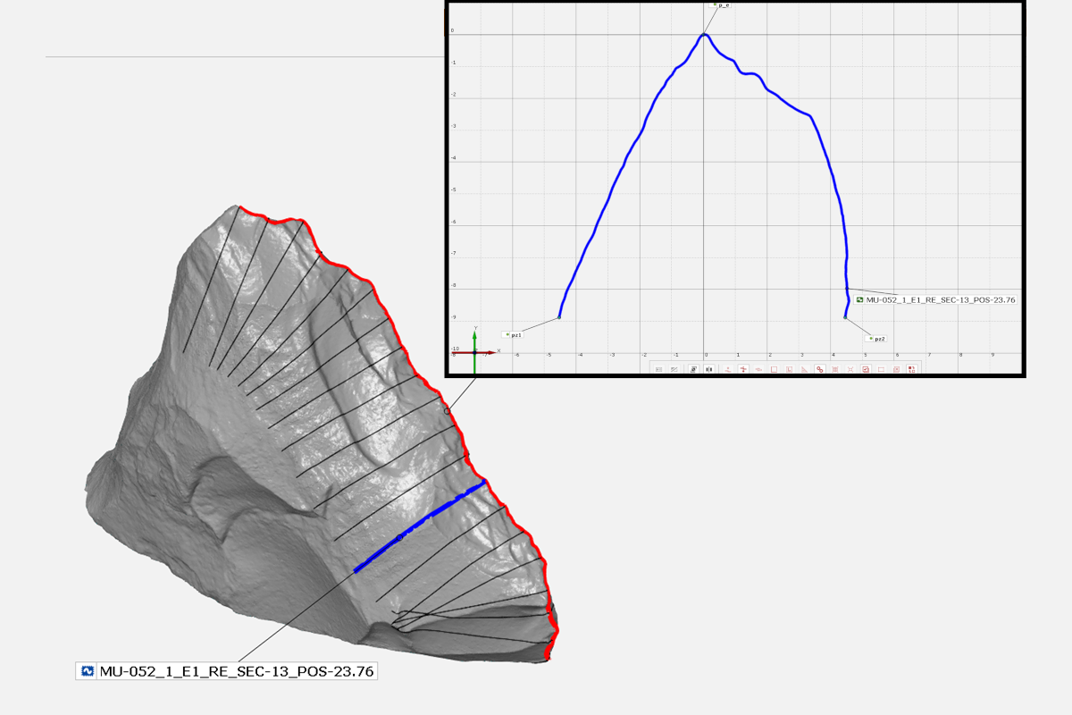 3D model of a wedge knife with defined cutting edge (red) and cuts defined above it (black, blue). Top right: Transformed section (blue) as basis for the derivation of parameters for mathematical description
© LEIZA
3D model of a wedge knife with defined cutting edge (red) and cuts defined above it (black, blue). Top right: Transformed section (blue) as basis for the derivation of parameters for mathematical description
© LEIZA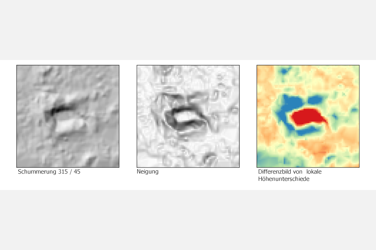 Visualisations of the results of analyses based on LIDAR data of a suspected archaeological site
© LEIZA
Visualisations of the results of analyses based on LIDAR data of a suspected archaeological site
© LEIZAMethods and software tools are being developed to derive comprehensible, comparable and reproducible parameters and parameters for the analysis of surfaces and surface structures on high-resolution digital 3D models of archaeological objects. In the EAP – the Edge Angle Project (2019-2021) – a joint concept for the shape analysis and quantification of cutting edges of Middle Palaeolithic wedge knives using digital 3D models was developed and implemented. The aim was to describe the shape of the cutting edges mathematically in order to obtain parameters for classification, comparison and statistical analysis. In this project, 2D sections on the 3D model, laid out at right angles to the cutting edge at defined intervals, serve as the basis for deriving parameters. The twenty sections created for each cutting edge provide the basis for the definition of parameters such as the calculation of angular dimensions with different approaches.
Digital terrain models from lidar surveys contain archaeologically relevant structures of the earth’s surface. In many cases, these data can also depict structures that are not visible in aerial photographs due to vegetation, e.g. in forests. Using various algorithms and procedures, these structures can be highlighted in visualisations on the one hand, and potentially relevant sites can be identified by applying suitable parameters on the other. The procedure allows the processing and analysis of large areas with the datasets available for many regions.
- Copy link
- Print article
Contact
- Dipl.-Ing. (FH) Guido Heinz
- +49 6131 8885-0
- Kontakt
Team
- Dipl.-Ing. (FH) Anja Cramer
- Dipl.-Ing. (FH) Guido Heinz
Project Period
- Since 01.2019